Hydrographic System
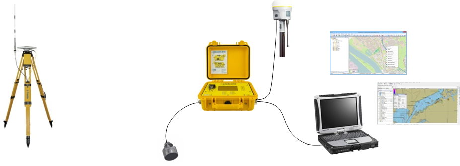
A hydrographic system is a technology used to survey and map the bottom of bodies of water, such as oceans, lakes, and rivers. The system typically consists of a survey vessel, specialized sensors, and software that can process and analyze the data collected by the sensors. The sensors can include sonar, laser, and other types of instruments that can measure water depth, seafloor topography, and other physical features of the underwater environment. The data collected by the system can be used to create accurate maps and charts for navigation, oceanographic research, and other applications..
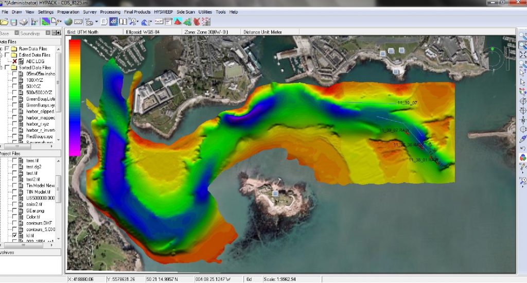
A hydrographic system is a technology used to survey and map the bottom of bodies of water, such as oceans, lakes, and rivers. The system typically consists of a survey vessel, specialized sensors, and software that can process and analyze the data collected by the sensors. The sensors can include sonar, laser, and other types of instruments that can measure water depth, seafloor topography, and other physical features of the underwater environment. The data collected by the system can be used to create accurate maps and charts for navigation, oceanographic research, and other applications..